Kudremukh
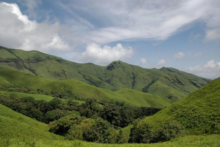
A horse-faced peak above shola grassland
Kudremukh trek country: a 600 sq km Western Ghats national park in Chikkamagaluru district, with a horse-face peak, shola hills and forest-permit day treks.
Overview
Kudremukh National Park covers 600.57 square kilometres of Western Ghats forest across Chikkamagaluru and Dakshina Kannada districts in Karnataka, made a national park in 1987 on land that had been reserved forest since 1916. Its name means "horse face" in Kannada, a reference to the outline of the main peak, which stands at roughly 1,890 metres. A Kudremukh trek is for hikers who accept forest-department conditions, and the months after the monsoon are the recommended time, when streams and falls are full.
The terrain is rolling hill, shola forest and open grassland, running from about 100 metres to the summit. Rain is extremely heavy here, put at around 7,000 mm a year, and it feeds the Tunga, Bhadra and Netravati rivers, all of which begin in these hills. Lion-tailed macaques live in the forests, and the park also holds leopards, sloth bears, gaur, sambar and over 200 bird species, so the trails reward anyone who walks quietly.
The summit hike is done in a single day. Day treks are permitted with permission from forest officials, camping is not allowed, and walkers must come down before sunset. Because the rules, permits and any monsoon restrictions are set by the forest department and change, check the current position with the department before building a trip around the peak.
Away from the summit, Kadambi Falls drops more than 100 feet and is reached on foot, with October to May the preferred stretch. Hanuman Gundi Falls and Gangamoola are the other places named for visitors, and Sringeri lies about 60 km away. Kudremukh town itself grew around the Kudremukh Iron Ore Company, which mined here for about three decades before closing in 2006.
Kudremukh town lies at about 815 metres. Kalasa, around 20 km from it, serves as the usual base, and Karkala is about 48 km away. Stays range from dormitories to homestays, so book beds ahead in busy months. Mangaluru has the closest airport, at roughly 100 to 135 km by road, and the nearest big railway stations are Udupi and Mangaluru.
Known for
A horse-faced summit of roughly 1,890 m, climbed as a day trek with permission
Quick facts
Rainfall is extremely heavy, put at around 7,000 mm a year, so streams and falls are fullest soon after the monsoon.
Mangaluru International Airport (IXE), about 100 to 135 km
Udupi, about 70 km; Mangaluru Central (MAQ) is also named as a nearby station
Roads run through Kalasa, about 20 km from the town, and Karkala is about 48 km away; NH66 and state highways serve the area.
Confirm permissions and any seasonal closure with the forest department before you book, since day treks need permission from forest officials
Plan to be off the peak well before sunset, as camping is not allowed and trekkers must descend by dusk
Base yourself at Kalasa, about 20 km from Kudremukh town, and arrange a homestay or dormitory bed in advance
Plan a trip to Kudremukh
Tell us your dates and we will shape the route.